
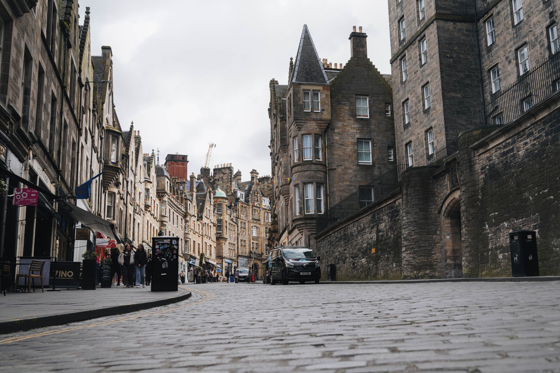
Edinburgh’s street map has changed dramatically over the centuries. Entire thoroughfares have been demolished to make way for railways, new buildings, and urban improvements. Unlike the closes – the narrow passageways that survive in the Old Town – many complete streets have vanished entirely, leaving little trace except in historical records and architectural memories.
These lost streets tell a story of how cities transform themselves. Some were sacrificed for major infrastructure projects like Waverley Station. Others disappeared during 19th-century efforts to widen the Royal Mile and improve traffic flow. A few succumbed to post-war modernisation schemes that, had they gone ahead, would have reshaped Edinburgh entirely.
Understanding what happened to these vanished thoroughfares reveals how Edinburgh’s urban identity has shifted, and what choices the city made about progress, commerce, and the balance between old and new.
Major Streets Lost to Railway Expansion
Edinburgh Waverley Station’s construction and expansion consumed some of the city’s most significant streets. The railway boom of the mid-19th century transformed the city’s geography, requiring the demolition of multiple thoroughfares to create the sprawling station complex that now sits at the heart of Edinburgh.
Canal Street
Canal Street was completely demolished to create space for Waverley Station. The street had once been a notable feature of Edinburgh’s transport infrastructure, but it vanished entirely as the railway company acquired land and consolidated the different station operations that served the city in the 1840s and 1860s.
Leith Wynd
This street met a split fate. The north end of Leith Wynd was demolished to create Waverley Station, whilst the southern end was removed to form what is now Jeffrey Street. The street’s bifurcation demonstrates how railway expansion fractured Edinburgh’s existing street pattern, forcing city planners to create new routes around the construction.
Gilmore Street and McDowall Street
Both of these streets disappeared during extensions to Waverley Station. As the railway facility expanded to accommodate increased traffic and more platforms, neighbouring thoroughfares were absorbed into the station’s footprint. These demolitions continued into the second half of the 19th century, showing that Waverley’s impact on Edinburgh’s geography was not a single event but an ongoing process.
The Luckenbooths and Royal Mile Clearance
Perhaps the most dramatic street transformation occurred along Edinburgh’s Royal Mile, where medieval and early modern structures were swept away to create a more open, accessible thoroughfare. The Luckenbooths represented a dense, historic layer of Edinburgh’s commercial life that city planners ultimately decided had to go.
What the Luckenbooths Were
The Luckenbooths were a series of interconnected tenements and shops that stood immediately north of St Giles’ Cathedral on the High Street, the central section of what is now called the Royal Mile. They originated as a timber-fronted booth row (known as the ‘Buith Raw’) built in 1440, and over subsequent centuries were extended and heightened until they formed seven tenement buildings of varying ages and sizes.
The buildings housed shops, particularly jewellers and traders of cheaper goods, but by the 18th century they had become notorious for congestion and poor conditions. A narrow, foul passage between the Luckenbooths and the north face of St Giles’ Cathedral was called the ‘Stinking Style’ – so named because refuse and sewage from the upper floors regularly cascaded down onto the street below.
Demolition and Urban Clearing
The Luckenbooths were not removed all at once. Luckenbooth Street itself was demolished in 1802, but the Parliament Square section of the tenements survived until 1817, when the Town Council finally ordered their complete removal. The goal was explicit: to widen the High Street, allow traffic to flow more freely, and reclaim St Giles’ Cathedral from the shadows cast by the crowded structures around it.
By the early 19th century, Edinburgh’s focus had shifted to the New Town, where elegant Georgian streets were being laid out on open land to the north. The Old Town’s medieval jumble began to seem like an obstacle to modernisation rather than a treasured inheritance. Demolition of the Luckenbooths was part of a broader ‘improvement’ scheme that included clearing the Guard House, the Weigh House, and eventually the Old Tolbooth itself.
Creating Cockburn Street
The demolition of structures along the High Street created space for a new thoroughfare. Cockburn Street was created in 1856 as a serpentine link from the High Street down to Waverley Station, which by then had opened but was accessible only via steep and narrow lanes. Rather than simply demolishing old closes (the narrow alleyways that characterised the Old Town), the construction of Cockburn Street required the removal of multiple properties and the reshaping of the urban fabric. The truncated ends of demolished closes were remodelled in Scots Baronial style between 1859 and 1864, creating the distinctive architecture visitors see today.
Streets Lost to Large Public Buildings
Beyond railway expansion, Edinburgh’s vanished streets also include several that were demolished to create major civic and cultural institutions.
Brown Square and Arthur Street
Brown Square was demolished to make way for George IV Bridge, Chambers Street, and the creation of what became the Museum of Scotland. Arthur Street, once described as the steepest street in Edinburgh, was demolished in the early 1960s. Salisbury Square and Salisbury Street were also cleared around the same period, removing residential areas to reshape the city’s administrative and cultural centre.
Argyll Square
This square was demolished to create space for the Royal Museum (now the National Museum of Scotland) on Chambers Street. The expansion of Edinburgh’s museum district required the erasure of earlier street patterns and residential communities.
Park Place
Park Place was demolished to accommodate the building of the University of Edinburgh’s medical school on Bristo Street. The university’s expansion in the 19th century reshaped entire blocks of the city, replacing existing streets with academic buildings.
Princes Street: The Street That Nearly Vanished
Princes Street, now Edinburgh’s most famous shopping street, came closer to wholesale demolition than most people realise. Whilst the street itself survived, its character has been radically transformed through successive redevelopments – and plans to erase it entirely were only narrowly avoided.
Victorian and Edwardian Alterations
Originally designed as part of Edinburgh’s New Town in the late 18th century, Princes Street was envisioned as a residential street of elegant Georgian townhouses facing south across Princes Street Gardens, with views towards the castle. The street’s character began to change in the 1820s when businesses started to convert the townhouses into shops and hotels. During the Victorian period, many of the original buildings were heavily altered, with bay windows, extra storeys, and commercial frontages added at ground and first-floor levels. Very few original Georgian frontages survive intact.
The Abercrombie Plan and Post-War Modernism
In 1949, a major urban plan proposed radical changes to Princes Street, with extensive redevelopment and retention of only three historic buildings. This plan, had it gone ahead, would have obliterated most of Princes Street’s surviving heritage architecture. A panel of architects and planners formed in 1954 to investigate the street’s improvement reported in 1967 that it looked messy due to the variety of building heights and styles. Their solution was equally drastic: demolish most of the buildings and replace them with new structures designed to a unified standard.
Fortunately, these plans were never fully implemented. However, Princes Street did lose significant portions of its character through selective demolition and modernist infill, particularly in the 1960s and later decades. The street today is a patchwork of Victorian survivors, modernist insertions, and contemporary commercial spaces – a palimpsest of different eras rather than a coherent 19th-century avenue.
Streets Lost to 1950s Infrastructure Projects
Edinburgh’s post-war modernisation brought further street demolitions, particularly on the city’s periphery where older working-class neighbourhoods were cleared for new developments.
Leith Fort Development Streets
Several streets disappeared during the Leith Fort redevelopment of the 1950s and 1960s. Cannon Street was demolished in the 1950s, as were Helen Place and London Row. These clearances were part of broader slum-clearance and urban renewal schemes that reshaped Edinburgh’s outer areas, replacing 19th-century tenement housing with new developments.
Dumbiedykes Construction
Craigside Place was demolished to build Dumbiedykes, a social housing scheme that transformed another section of the city’s fabric.
The Nor Loch Transformation: When Water Became Parks and Gardens
One of the most significant erasures in Edinburgh’s geography involved not streets themselves but the complete transformation of the landscape beneath what would become Princes Street Gardens. This illustrates how Edinburgh’s street pattern has been shaped by changes to the natural environment.
From Marsh to Loch to Parks
The Nor Loch was originally a marshland on the north side of medieval Edinburgh, used as part of the city’s medieval defences. Over centuries it accumulated sewage and waste, becoming increasingly polluted. The loch was progressively drained from the 1760s onward, with the western section drained between 1813 and 1820 ahead of building the New Town, and Princes Street Gardens occupy the valley today. The area was formally created as public gardens in the 1820s, with the valley finally becoming the green space that separates the Old and New Towns.
Whilst this transformation created one of Edinburgh’s most beloved public spaces, it also erased an entire ecosystem and changed the city’s hydraulic systems fundamentally. The Nor Loch’s water was re-routed around the castle rock, eventually becoming the first underground sewer system in Edinburgh, running along the line of Cowgate.
Why Streets Disappeared: The Patterns Behind Demolition
Edinburgh’s lost streets disappeared for several clear reasons:
- Railway expansion – The construction and growth of Waverley Station required the most dramatic street demolitions, consuming entire thoroughfares to create the station complex and its tracks.
- Urban widening and traffic – Medieval closes and the Luckenbooths were seen as obstacles to modern commerce and movement. City councils prioritised wide, straight streets over the organic, narrow patterns of medieval Edinburgh.
- Administrative and cultural expansion – Universities, museums, and civic buildings required space, and existing streets were cleared to accommodate them.
- Post-war modernisation – The 1950s and 1960s brought slum clearance, infrastructure projects, and redevelopment schemes that reshaped working-class areas.
- Commercial transformation – Princes Street and the Royal Mile evolved from residential areas into commercial zones, with numerous buildings altered or demolished to serve retail, office, and hotel functions.
What Survives: Ghosts of Lost Streets
Although the streets themselves have vanished, traces remain for those who know where to look:
- Street names – The surviving sections of streets sometimes bear clues to their former extent. Jeffrey Street, for example, incorporates the southern section of the former Leith Wynd.
- Buildings and stones – Carved architectural fragments from demolished structures survive in museums and in situ. A pediment from the Netherbow Port (a medieval gateway demolished in 1764) is built into a modern building on the High Street, a few doors from John Knox House.
- Underground spaces – Mary King’s Close, buried beneath the City Chambers, preserves a 17th-century street and the remains of buildings that were built over rather than demolished. The Lost Close, rediscovered in 2019 during refurbishment of the former police chambers, shows that entire structures can survive underground.
- Historical maps and records – Maps by Robert Kirkwood (1819) and other historical cartographers document the city’s street layout before major demolitions, preserving the memory of what has been lost.
- Architecture and landmarks – St Giles’ Cathedral’s reopened facade, visible after the Luckenbooths were cleared, shows how demolition can unexpectedly reveal historic structures that had been hidden for centuries.
A City Constantly Remaking Itself
Edinburgh’s vanished streets are part of a larger pattern of urban transformation. Unlike some cities that preserved medieval street plans, Edinburgh repeatedly chose to reshape itself according to contemporary ideas about progress, commerce, and modernity. The Luckenbooths gave way to a more open High Street. Canal Street and Leith Wynd were absorbed into railway infrastructure. Arthur Street and Salisbury Square disappeared to make way for museums and civic buildings. Princes Street itself nearly fell victim to post-war modernist planning.
Each demolition represented a choice – sometimes necessary, sometimes debatable – about which parts of the city’s past should be kept and which should be sacrificed. Today, as new development continues across Edinburgh, understanding these lost streets provides perspective on how the city has evolved, and reminds us that urban change is constant and often irreversible.
The physical traces may be gone, but the story of Edinburgh’s vanished streets is preserved in historical records, buried structures, architectural fragments, and the shape of the modern city that grew in their place. For anyone interested in Edinburgh’s evolution from medieval burgh to New Town elegance to 19th-century commercial hub to modern city, these lost thoroughfares are an essential part of understanding how Edinburgh became what it is today.
Frequently Asked Questions About Edinburgh’s Vanished Streets
Why were the Luckenbooths demolished?
The Luckenbooths were demolished – partly in 1802 and completely by 1817 – because they were seen as obstacles to traffic flow and modern urban planning. The Town Council wanted to widen the High Street, improve access to daylight, and reclaim St Giles’ Cathedral from the shadows. By the early 19th century, when the New Town’s elegant Georgian streets were attracting commerce and residents, the Old Town’s medieval jumble seemed like a relic of the past rather than a valuable inheritance.
How many streets disappeared to build Waverley Station?
Multiple streets were demolished for Waverley Station and its expansions: Canal Street, Leith Wynd (north end), Gilmore Street, and McDowall Street. The Edinburgh Orphan’s Hospital was also demolished in 1845 to make space. The station’s construction and successive expansions took place over several decades from the 1840s onwards, so the impact on the surrounding street pattern was cumulative rather than a single event.
Are any of Edinburgh’s lost streets still accessible today?
Not in their original form, but some survive underground. Mary King’s Close, buried beneath the City Chambers, preserves a 17th-century street and can be visited. The Lost Close was rediscovered in 2019 and is now accessible to the public. Above ground, the sites of vanished streets are often marked by buildings that replaced them or by street names that preserve the memory of what once stood there.
Could Princes Street have been demolished entirely?
Yes. The 1949 Abercrombie Plan proposed radical redevelopment of Princes Street, retaining only three historic buildings. A 1954 panel of architects and planners suggested demolishing most of the street’s varied buildings and replacing them with uniform modernist structures. These plans were never fully implemented, though Princes Street did undergo significant selective demolition and modernist infill, particularly in the 1960s onwards.
Why wasn’t Edinburgh’s street pattern preserved like some other historic cities?
Edinburgh’s approach to urban development emphasised modernisation and commerce over heritage preservation. The city’s transition from medieval burgh to New Town commercial centre meant that old patterns were often seen as obstacles rather than assets. Railway expansion, expanding institutions, and post-war modernisation all prioritised practical urban functions over the preservation of historic street layouts.
What can visitors learn from Edinburgh’s lost streets?
Understanding Edinburgh’s vanished thoroughfares reveals how cities evolve, make choices about development, and balance progress with preservation. Walking the Royal Mile and visiting underground close tours provides perspective on what has been lost and gained. Historical maps and museums document the streets that have disappeared, offering visitors a richer understanding of Edinburgh’s complex, layered urban identity and the continuous process of urban transformation.