
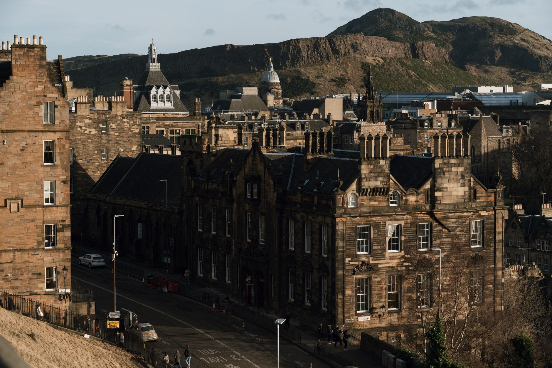
Anyone who has walked Edinburgh’s cobbled streets knows the experience: streets that suddenly pitch upward at angles that make your calves burn, or descend so steeply you have to lean back to stay balanced. The physical challenge of Edinburgh’s topography is one of the first things visitors notice, yet few understand why the city is built on such dramatic slopes. The answer lies in ancient volcanic eruptions and the relentless work of ice-age glaciers – geology that continues to shape how people navigate, live, and experience Edinburgh today.
Edinburgh’s extreme hills aren’t random. They follow a pattern that has defined the city for over a thousand years, from the choice of where Edinburgh Castle was built to why the Royal Mile slopes so uniformly downhill. Understanding this geology transforms a frustrating climb into a window onto deep time, and helps any visitor plan a trip that works with the landscape rather than against it.
The story begins 340 million years ago, in a tropical sea.
The Volcanic Foundations
Edinburgh sits on the remnants of ancient volcanoes. The city’s most recognisable landmarks – Arthur’s Seat, Castle Rock, and Calton Hill – are not mountains but volcanic plugs: the cooled, hardened cores of volcanoes that erupted when much of central Scotland lay beneath shallow tropical seas during the Carboniferous period.
Castle Rock, where Edinburgh Castle stands, is a particularly instructive example. This distinctive crag is composed of extremely hard igneous rock called dolerite. When the volcano that created it stopped erupting and cooled, the molten rock solidified into stone that proved almost impossible to erode. Arthur’s Seat, Edinburgh’s highest point at 251 metres, is likewise an extinct volcano whose hard volcanic rock has resisted weathering for hundreds of millions of years.
Around these volcanic peaks, a different geology dominates. The softer sedimentary rocks that surround the volcanic formations – primarily sandstone and shale – eroded far more easily over geological time. This contrast between tough volcanic rock and softer sedimentary stone is the key to understanding Edinburgh’s topography.
Glaciers Sculpting the Landscape
The city’s characteristic steep hills owe more to recent glacial history than to the original volcanic eruptions. Starting around 2.5 million years ago, the Earth’s climate cooled, and vast ice sheets repeatedly advanced and retreated across Scotland. During the last major glaciation, which peaked around 20,000 years ago, ice up to a kilometre thick covered Edinburgh.
As glaciers moved across the landscape, they had a dramatic effect on different rock types. The hard volcanic rock of places like Castle Rock and Arthur’s Seat was extremely resistant to erosion. Ice could not easily wear these formations away. In contrast, the softer sedimentary rocks surrounding the volcanoes were scooped out much more readily. Glaciers carved deep hollows around the volcanic plugs as they moved, creating a landscape of sharp contrasts.
The ‘Crag and Tail’ Formation
This glacial process created what geologists call a “crag and tail” formation – exactly the landform that defines Edinburgh’s city centre. Castle Rock is the ‘crag’: a hard volcanic plug that stood firm against glacial erosion, now topped by the castle itself. The ‘tail’ is the gently sloping ridge of softer sedimentary rocks stretching east from the castle, protected from the full force of the ice. This is the Royal Mile.
The Royal Mile’s uniform downhill slope – running roughly 1.4 kilometres from Edinburgh Castle down to Holyrood Palace – is not accidental. It exists because the hard Castle Rock protected the softer rocks immediately behind it from being completely scoured away. The glacial ice, moving from west to east, couldn’t demolish this protected ridge, so it remained as a relatively gentle slope once the ice melted away.
The same pattern repeats elsewhere in the city. Calton Hill, another prominent volcanic outcrop, also benefits from glacially-protected softer rock on its lee side. The contrast between the sheer cliffs on exposed sides and gentler slopes on protected sides is visible throughout central Edinburgh.
Why Some Streets Are Steeper Than Others
Edinburgh’s steepest streets often follow routes where the underlying geology changes sharply, or where development has respected the natural contours of older volcanic hills.
Ramsay Lane, which runs off the Mound near Waverley Station, is Edinburgh’s most famous steep street. It has a gradient of around 15.7 per cent as it climbs sharply toward the heart of the Old Town. Ramsay Lane’s extreme slope exists because it follows a route that climbs directly up a ridge of harder rock with minimal protection from gentle sloping ground.
In contrast, streets on slopes that follow the natural ‘tail’ of glacially-protected rock (such as the lower sections of the Royal Mile) are noticeably gentler. The difference isn’t just in steepness; it’s in the underlying rock type and how glacial erosion worked on it.
The Seven Hills of Edinburgh
Edinburgh’s distinctive topography means the city was built on multiple high points. According to local tradition, the original city grew around “seven hills” – though the exact seven hills have debated over centuries. The main volcanic hills that have shaped settlement and development include:
- Arthur’s Seat – at 251 metres, Edinburgh’s highest point and an ancient volcano in Holyrood Park
- Castle Rock – the defensive stronghold at 350 million years old
- Calton Hill – a displaced fragment of the Arthur’s Seat volcano, topped with monuments
- The Pentland Hills – to the south, formed from more ancient volcanic rocks over 400 million years old
- The Braid Hills and Blackford Hill – remnants of volcanic activity
These hills didn’t just create the city’s visual drama; they determined where Edinburgh could be defended, where water would flow, and which areas could be easily settled.
Practical Implications for Visitors
Planning Your Route
Understanding Edinburgh’s geology makes route planning much easier. If you’re staying in the city centre and want to minimise steep climbing, the New Town area offers significantly gentler terrain than the Old Town. The New Town itself is built on a ridge of land that rises gradually from the Firth of Forth to the north, but it has nothing like the dramatic slopes of the Old Town streets and closes.
The Royal Mile, whilst appearing to slope uniformly downhill, is deceptive. The section closest to the castle (Castlehill) sits on or very near Castle Rock itself and can feel steep, while the lower sections around High Street and Abbey Strand slope more gradually. Walking downhill from castle to palace is far easier than the reverse.
Streets that climb directly up volcanic hills – like the approaches to Arthur’s Seat or Observatory Road on Calton Hill – will be considerably steeper than streets that follow the natural contours of glacially-protected ‘tails’.
Accommodation and Access
Edinburgh’s hills create genuine accessibility challenges for disabled visitors and those with reduced mobility. The steep cobbled streets of the Old Town, whilst atmospheric, are genuinely difficult for wheelchair users or anyone with mobility difficulties.
Visitors with mobility concerns may find the New Town more manageable, though many routes still involve uphill walking. Some accessible hotels are specifically located to minimise steep approaches. Blue badge holders can arrange accessible car parking on the castle Esplanade, and a mobility vehicle service is available to transport wheelchair users up the steep cobbled approach to Crown Square inside the castle.
Mobility scooter and wheelchair rental services are available in Edinburgh; many disabled visitors find these essential for managing the hills. Public buses have wheelchair spaces with ramps, and Edinburgh’s tram system is fully wheelchair accessible at every station.
Choosing Accommodation Strategically
Where you stay matters significantly for managing hills. Hotels on the lower slopes of the New Town or near Waverley Station reduce the need to climb. Hotels on the Royal Mile itself often have ground-floor accessibility, but reaching them may involve climbing. The area around Waverley Station sits in a glacial hollow and offers relatively flat access to many central attractions.
Physical Preparation
If you enjoy walking but don’t regularly climb hills, Edinburgh will test your fitness. The climb to Edinburgh Castle, Arthur’s Seat, or even from Waverley Station to the upper New Town can be genuinely exhausting if you’re not prepared. Many visitors find comfortable shoes with good grip essential – Edinburgh’s cobbles can be slippery, especially when wet, and the steep slopes increase the risk of slipping.
Pacing yourself matters. A slow walk down the Royal Mile, stopping frequently to look at buildings and shops, is far more pleasant than trying to stride straight down.
Geology as Visible History
The great advantage of understanding Edinburgh’s geological story is that you can literally see it as you walk. The contrast between the hard, dark volcanic rocks and the softer, lighter-coloured sandstone is obvious on many streets. Castle Rock’s sheer cliffs on three sides and its sloping eastern face directly show the crag-and-tail formation. Arthur’s Seat’s steep volcanic slopes, visible from across the city, remind you that this was once an active volcano.
Edinburgh’s geology inspired the father of modern geology himself. James Hutton, who lived in Edinburgh in the 18th century, studied the rocks visible throughout the city – particularly at Salisbury Crags near Arthur’s Seat – and developed revolutionary ideas about how slowly geological processes work. His observations in Edinburgh helped establish that the Earth is vastly older than anyone had previously believed.
This is visible, tangible history. The streets you walk on, the hills you climb, the reason the castle sits exactly where it does – all of it comes from events hundreds of millions of years ago.
Frequently Asked Questions
Is Edinburgh always this hilly?
The central Old Town and the areas immediately around it are genuinely steep. The New Town is less dramatic. Further out from the centre, many neighbourhoods are built on flatter ground. If you can avoid the very steepest streets and take trams or buses when needed, you can manage much of the city with far less climbing than a first visit might suggest.
What’s the steepest street I’m likely to encounter?
Ramsay Lane, off the Mound, is the steepest in the Old Town at about 15.7 per cent gradient. For context, a 15 per cent gradient is steep enough that you’ll notice it – roughly equivalent to a difficult hill climb. Most other well-known Old Town streets are somewhat less extreme, though they’re still noticeably steep.
Why is the Royal Mile so much easier going downhill than uphill?
The Royal Mile follows the natural crag-and-tail formation. Walking uphill from Holyrood Palace toward the castle means climbing up the protected ‘tail’ of softer rock. Walking downhill is simply the reverse. However, the overall slope is gentle enough that many people find the downhill walk easier purely because gravity helps, even though the gradient is the same.
Can I avoid steep hills entirely?
Not entirely, if you want to see Edinburgh’s most famous attractions. Edinburgh Castle sits on a volcanic crag, Arthur’s Seat is the city’s highest point, and these views are worth the effort for most visitors. However, you can use transport (buses, trams, or black cabs with wheelchair ramps) to reach elevated areas and then explore level or downhill routes from there. The New Town area itself, whilst not flat, is far less demanding than the Old Town.
Why did people build a city on such steep hills?
Castle Rock’s steep sides provided defence, which was essential in medieval Scotland. Its position on hard volcanic rock made it almost impossible to tunnel under or break through. The Royal Mile’s naturally sloping ground allowed a main street to run the entire length of the old town without major engineering. Once the medieval city was established, later expansion simply followed the terrain that existed. Edinburgh’s geology actually made settlement easier, not harder, for the medieval builders who chose the site.
Does the weather make the hills harder or easier?
Both, in different ways. Rain makes Edinburgh’s cobbled streets significantly more slippery, which makes steep streets genuinely hazardous. Frost can be dangerous. However, Edinburgh’s grey, cool climate does mean you’re less likely to overheat while climbing. Snow is rare enough that it’s generally not a major factor. Wet weather is the real concern for anyone climbing steep streets.
Edinburgh’s Slopes as Part of the Experience
Edinburgh’s dramatic topography isn’t simply an obstacle for visitors to overcome – it’s fundamental to what makes the city distinctive. The steep slopes, the sudden views that open up as you climb, the way the castle emerges into view as you climb the Royal Mile, the vista across the city from Arthur’s Seat: all of these exist because of ancient geology. The hills slow you down, force you to look around, and prevent the city from being just another collection of streets and buildings.
By understanding why these hills exist – that they’re the result of volcanic eruptions hundreds of millions of years ago, shaped by glaciers during the last ice age, and that the hard rock beneath Edinburgh’s Old Town is fundamentally different from the softer stones protecting the Royal Mile’s slope – you transform a frustrating climb into something far more interesting. You’re walking on visible geological history, following routes that were determined before humans existed, in a landscape carved by forces of unimaginable scale and time.